Compiled by Peter McFadden, updated January 2023.
This is one of our most-visited website pages!
Conwy Mountain is sheep farming country. Keep your dog on a lead. Follow the Dog Walking Code
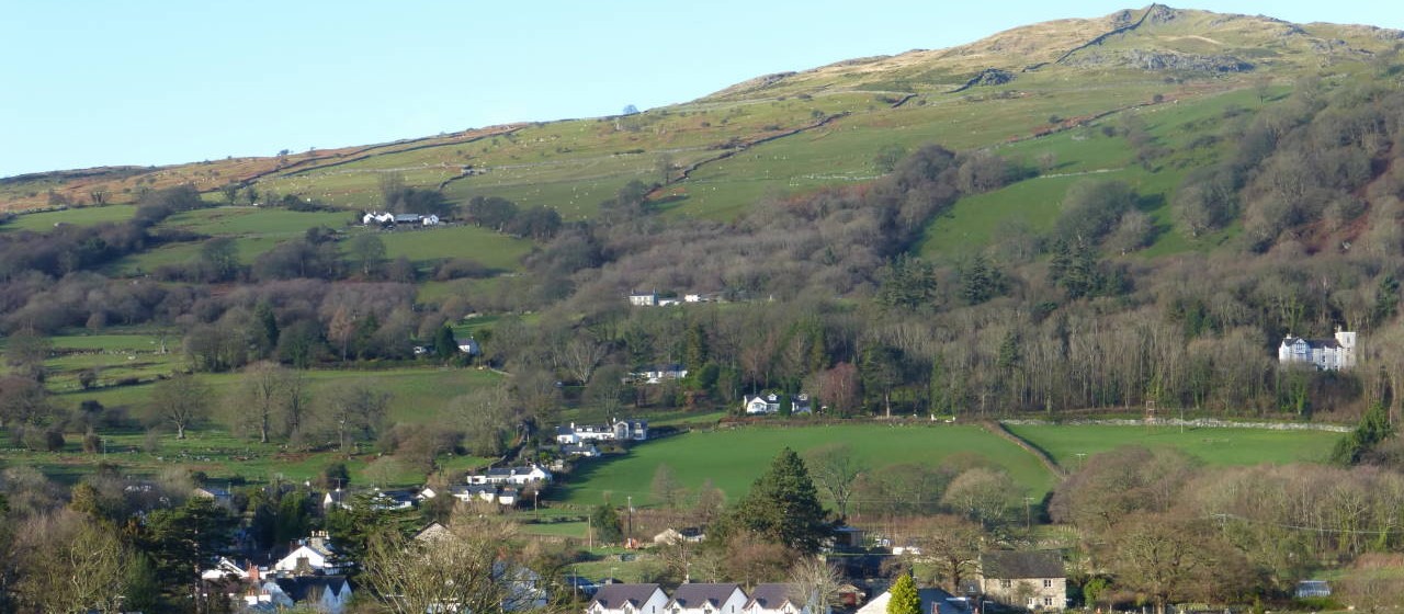
Conwy Mountain or Mynydd y Dref (Town Mountain) 801ft, offers wonderful walking at any time of year, just a few minutes from Conwy town. August and early September are the best times to walk here, when the hills are covered in gorse and heather in flower.
Fine honey is made from the heather here, and it sells well at the 700-year old Conwy Honey Fair every September 13th.
There are easy to follow paths in all directions. This is a place where you can devise your own favourite walk. The path over the summit passes the Iron Age Hill Fort
Go well-prepared, with walking boots, an OL17 Explorer map, waterproofs, and food and drink. Take note of any warning signs, especially the sign warning of a steep drop. Enjoy your visit, and observe the Countryside Code
Feedback, June 2019
I just wanted to thank you for your excellent directions on where to park and climb Conwy Mountain. My son who suffers from acute asthma has good days and bad days and today was not a great day, but he wanted a challenge bigger than Moel Famau, but didn’t want to travel as far as the Ogwen Valley (our usual haunt on good days) so we followed your directions, and just wanted to say how precise and perfect they were. We made it to the top and he felt accomplished.
Thanks again.
Waymarkers on Conwy Mountain.
The red and yellow signs refer to the 12-mile Upland Route of the Wales Coast Path, from Conwy to Llanfairfechan. This is an alternative to the easier Coastal Route, which is marked with blue roundels. (We are presently walking the Wales Coast Path. We have reached Gower, and we hope to complete the 870-mile walk from Chester to Chepstow in summer 2023).
The green North Wales Path signs refer to the path from Bangor to Prestatyn.
You can follow the red and yellow signs down into Capelulo and visit the Fairy Glen pub.
Directions onto Conwy Mountain…
1. From Conwy Quay
Start at the Wales Coast Path sign, opposite The Liverpool Arms. Follow the red and yellow Wales Coast Path signs.
-
Pass the Smallest House, go through the arch and walk along Marine Walk, next to the Conwy Estuary.
-
Turn left at Ysgol Aberconwy and head for the main road. Cross the road at the pedestrian crossing, and then cross the metal railway bridge.
-
Continue uphill, passing houses on your left, until you reach a row of houses on the right. Bear right over a stile onto Conwy Mountain.
2. From Sychnant Pass Road. Walk from Conwy town.
-
Leave Conwy via Uppergate. Turn left off Bangor Road onto Uppergate Street, at the Albion Alehouse corner (and return there later, well recommended).
-
Go through the arch, and follow the sign for Sychnant.
-
Pass Conwy Youth Hostel.
-
After 200 metres, cross the road near new houses at Rhodfa Sychnant.
-
Go through a kissing gate, and follow footpath along field edge to a footbridge.
-
Up a narrow path. Cross the lane, Conwy Council sign on path, and continue up a steep path through bracken.
-
Turn left at the main path and stop for a rest by a very large rock. This path is a good route to take to go back down to Conwy later. You can visit the town and walk back up to the car.
-
Great views from here down to Conwy town and castle.
-
The main path continues over the mountain, with side paths in all directions.
3. From Mountain Road. Walk from Conwy town.
-
Leave Conwy by the Bangor Road arch. Take second left across a narrow railway bridge into Cadnant Park, with attractive Victorian houses. Pause to look down at the deep railway cutting.
-
The road bears left and uphill. Take first turning on right onto Mountain Road.
-
Pass houses on both sides of the lane. Mountain Road becomes a signposted footpath, and you are then on the track up Conwy Mountain.
4. From the top of Sychnant Pass, public car park near LL32 8AZ.
-
Leave Conwy via Uppergate. 100 metres past Lancaster Square and Llewelyn’s statue, turn left off Bangor Road into Uppergate Street, at the Albion Alehouse corner.
-
Go through the arch, and follow the sign for Sychnant.
-
After 2 miles, pass the driveway up to Pensychnant Conservation Centre on your right, well worth a visit.
-
Pass Snowdonia National Park public car park on left at LL32 8AZ.
-
Continue between high stone walls. Be aware of oncoming vehicles.
-
Off-road car parking on both sides of the road, just past the end of the two walls.
-
Cross the road to a footpath onto Conwy Mountain at Echo Point. Try it!
-
Follow the North Wales Path signs, to visit the hill fort and the climbing slabs.
We’d welcome your comments and suggestions for other access points.
Please email peterhoney914@gmail.com


